Richley Reserve to Carnley Reserve Circuit

1 hr 15 mins
2.9 km Circuit

96 m
Moderate track
Blackbutt Reserve
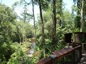
Blackbutt Reserve, near Newcastle, occupies over 182 hectares of land and provides visitors with the chance to enjoy nature trails[1], wildlife exhibits[2][3], children’s playgrounds[4] and recreational facilities. The reserve is the perfect place for a relaxing family picnic or to explore on a bushwalk. Native wildlife, such as the Powerful Owl and the Grey-headed flying fox[5] can be seen within the park. There is an information cottage[6] at Carnley Avenue, which is open 7am to 5pm, or 7am to 7pm during daylight savings. The reserve has car parking at Carnley Avenue, Richley Reserve, Lookout Road and Mahonoy Drive. For more information, phone 02 4904 3344.
Richley Reserve
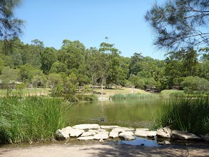
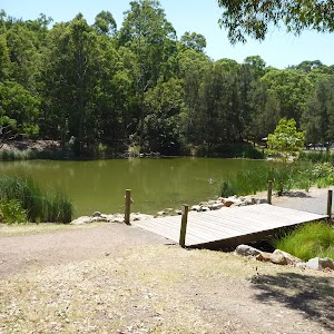
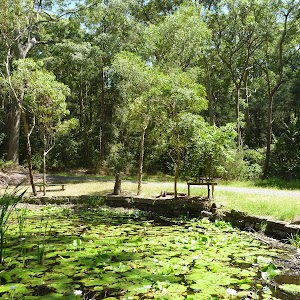
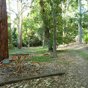
The Richley Reserve, within Blackbutt Reserve, has a park office[7], large pond areas[8] with swans (beware the swans[9] as they defend their territory), sheltered picnic tables[10], water taps[11], toilets[12], open grassed areas[13], a children’s playground[14], electric barbecues[15] and a car park[16]. The Richley Reserve car park has disability friendly parking and is open from 7am to 5pm or 7am to 7pm during daylight savings. For further information phone 02 4904 3344.
(0km) Richley Reserve (Car Park) → Int of Richley Reserve & Tall Tree Walk (loop)

200 m
4 mins
5m
-6m
Very easy
From the Richley Reserve (Car Park)[17], this walk follows the car park gently downhill, while leaving the ponds directly behind you. This walk continues for about 150m, to find a three-way intersection[18][19], with a metal gate and ‘Blackbutt Reserve – Freyberg St Entrance’ sign[20] (on the right). This walk turns right and continues gently uphill for about 45m, passing through the metal gate, until coming to a three-way intersection[21] with a sealed trail and ‘Tall Tree Walk (loop)’ sign[22] (on the left).
(0.2km) Int of Richley Reserve & Tall Tree Walk (loop) → Int of Main Ridge AND Tall Trees Walks

660 m
13 mins
32m
-3m
Easy track
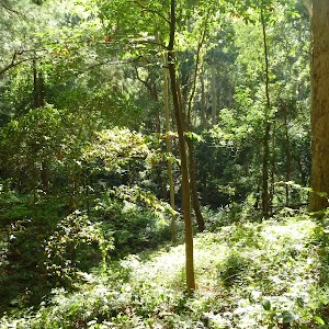
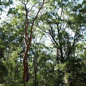
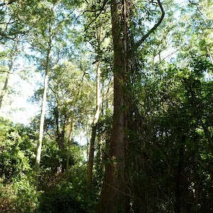
Veer left: From the intersection[23][24], this walk follows the ‘Wildlife Exhibit’ sign[25] and trail gently uphill, while keeping the valley on your left. This walk continues through forest[26] for about 300m, until coming to a faint three-way intersection[27] with a track on the left (houses[28] visible on the left) at a right-hand turn in the trail.
Turn right: From the intersection[29][30], this walk follows the trail gently uphill[31], while leaving Dunkley Ave and the houses[32][33] directly behind. This walk continues through attractive forest[34] for about 400m until coming to a four-way intersection[35], with a ‘Main Ridge Walk (loop) sign[36] (on the right) and a timber seat[37].
Turn right: From the intersection[29][30], this walk follows the trail gently uphill[31], while leaving Dunkley Ave and the houses[32][33] directly behind. This walk continues through attractive forest[34] for about 400m until coming to a four-way intersection[35], with a ‘Main Ridge Walk (loop) sign[36] (on the right) and a timber seat[37].
(0.85km) Int of Carnley & Tall Trees Trails → Carlney Ave Car Park (Eastern end)

270 m
7 mins
0m
-28m
Moderate track
Turn left: From the intersection[38][39], this walk follows the trail gently downhill[40], while moving directly away from the face of the ‘Richley Car Park’ sign[41] and keeping the valley on the left. This walk continues, undulating for about 170m until coming to a three-way intersection[42], with a trail and metal ring fence[43] (on the left).
Veer left: From the intersection[44][45], this walk follows the trail gently downhill, while keeping the metal ring fence on your right. This walk continues for about 60m, until passing around a locked metal gate[46][47] and coming to the end of the metal ring fence and the Carnley Avenue car park[48][49].
Veer left: From the intersection[44][45], this walk follows the trail gently downhill, while keeping the metal ring fence on your right. This walk continues for about 60m, until passing around a locked metal gate[46][47] and coming to the end of the metal ring fence and the Carnley Avenue car park[48][49].
(1.13km) Carlney Ave Car Park (Eastern end) → Carnley Ave Car Park (western end)

140 m
2 mins
2m
-2m
Very easy
Veer right: From the intersection[50], this walk follows the road gently downhill through the car park, while leaving the metal ring fence[51] and locked metal gate directly behind. This walk continues for about 60m, turning right (leaving Carnley Avenue on the left in the distance). Then this walk continues for about 40m, to come to a three-way intersection, with a footpath and ‘Blackbutt Reserve – Carnley Ave Car Park’ sign[52] on the right. This walk then continues straight ahead for about 50m, crossing a bridge over Black Duck Creek[53] and then continuing gently uphill for about 50m, until coming to a three-way intersection[54][55] with a footpath and ‘Blackbutt Reserve – Carnley Ave Entrance’ sign[56] (on the right).
Carnley Ave Reserve
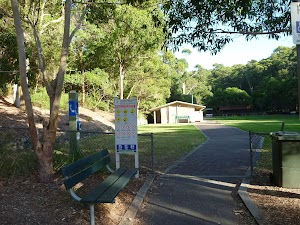
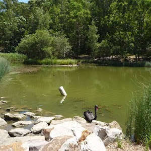
The Carnley Avenue Reserve, within Blackbutt Reserve, is wheelchair accessible and has toilets[57], drinking fountains[58], gas/electric barbeques[59], sheltered picnic tables[60], a children’s playground[61], fenced displays of kangaroos and emu[62], a large black duck pond[63] and an information centre[64] that is housed within a replica pioneering cottage. The information cottage has a range of souvenirs, focusing on quality and affordable products. A fee of $4 per vehicle can be paid from the automatic machines[65] in the car park. The information centre is open 7am to 5pm, or 7am to 7pm during daylight savings. For further information phone: 02 4904 3344.
(1.26km) Carnley Ave Car Park → Int of Boardwalk & Carnley Trail

110 m
2 mins
4m
0m
Easy track
Turn right: From the Carnley Ave Car Park[66][67] (Off Carnley Ave, Kotara), this walk follows the footpath through the metal fenced gate way[68], while initially keeping the ‘Blackbutt Reserve – Carnley Ave Reserve’ sign[69] on your left. This walk follows the footpath for about 90m (passing toilets[70], picnic tables and a children’s playground[71] on the left), until coming to a four-way intersection[72], with Black Duck Pond[73] directly ahead and a replica pioneering cottage on the left.
Turn left: From the intersection[74], this walk follows the ‘Animal’ sign[75] and sealed trail gently uphill, while initially passing the replica pioneering cottage[76][77] on the right. This walk continues for about 20m until coming to a three-way intersection[78], with a large timber fenced gate[79] (on the right).
Turn left: From the intersection[74], this walk follows the ‘Animal’ sign[75] and sealed trail gently uphill, while initially passing the replica pioneering cottage[76][77] on the right. This walk continues for about 20m until coming to a three-way intersection[78], with a large timber fenced gate[79] (on the right).
(1.37km) Int of Boardwalk & Carnley Trail → Int of Boardwalk & Main Ridge Trail

100 m
2 mins
2m
-2m
Very easy
Turn left: From the intersection[80][81], this walk follows the sealed trail gently uphill, while initially passing the large timber fenced gate[82] on the right and keeping the valley on the left. This walk continues for about 90m, passing an ‘Animals’ sign[83] and ‘Information’ sign (on the right) and concrete stairs (on the left), until coming to a four-way intersection[84], with an ‘Animals’ sign and elevated boardwalk[85] (on the right) and disabled parking[86] and general car parking (on the left).
Blackbutt Wildlife Exhibits
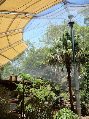
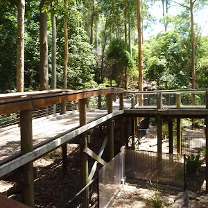
This boardwalk in the Blackbutt Reserve offers wildlife exhibits[87] on an elevated timber boardwalk which is wheelchair accessible. Some of the wildlife that you are likely to encounter are kangaroos, koalas[88], wombats[89], Lace monitors[90], Wonga Pigeons, Red-winged Parrots, Black-winged Stilt[91], Buff-banded Rail, Herons[92], Eastern long-necked Turtle, Kingfishers[93], Turquoise Parrot, Banded Plover, Peaceful Dove[94], Cockatoos, Lorikeets, True Parrots, Major Mitchell Cockatoo, Bush Stone Curlew, Long-tailed Finch and Barking Owls[95]. Entry is free and the exhibit is open from 9.00am to 5.00pm every day (closed Christmas Day, Good Friday and until 1pm ANZAC Day). Personal koala encounters[96] are available at 2pm daily and cost $3.50/person. For further information, phone: 02 4904 3344. More info.
(1.47km) Int of Boardwalk & Main Ridge Trail → Int of Boardwalk & Carnley Trail

380 m
8 mins
12m
-13m
Very easy
Turn right: From the intersection[97][98][99], this walk follows the ‘Animals’ sign[100] and timber boardwalk gently uphill, while initially keeping the car park[101] on the right. This walk continues, undulating for about 300m on an elevated boardwalk[102] through large and small animal enclosures[103][104], with a fascinating selection of native animals[105][106] and birds[107][108][109]. Then this walk continues on a sealed footpath for about 70m, until passing through a high timber fenced gate and coming to a three-way intersection, with a sealed trail[110] (on the left towards the pond[111]) and a trail[112] directly ahead.
(1.85km) Int of Boardwalk & Carnley Trail → Carnley Avenue Reserve

20 m

0m
-2m
Very easy
Turn left: From the intersection[113], this walk follows the sealed trail[114] gently downhill and towards the Black Duck Pond[115], while initially keeping the large timber fenced gate[116] on your left. This walk continues for about 20m until coming to a four-way intersection[117], with the replica pioneering cottage[118][119], Black Duck Pond and a ‘Richley Reserve’ sign[120] (on the left).
(1.87km) Carnley Avenue Reserve → Int of Blueberry Ash Walk & Carnley Trail

130 m
2 mins
9m
-1m
Easy track
Continue straight: From the intersection[121][122], this walk follows the sealed road, while initially keeping the Black Duck Pond[123] on your left and the replica pioneering cottage[124][125] directly behind you. This walk continues, passing the Black Duck Pond (on the left) and continues gently uphill[126] for about 150m (passing a sheltered picnic area[127] and children’s playground on the right) until coming to a three-way intersection[128] with a gravel trail (on the left), a metal ring fence (on the right) and a ‘Main Ridge Walk (loop)’ sign[129].
(2km) Int of Carnley Trail & Blueberry Ash Walk → Int of Carnley & Tall Trees Trails

310 m
6 mins
18m
0m
Moderate track
Veer right: From the intersection[130], this walk follows the ‘Main Ridge Walk (loop)’ sign[131] on your left and trail gently downhill. This walk continues through forest with a metal ring fence (on the left) for about 170m, until coming to a three-way intersection[132][133] with a gently downhill trail[134] (on the right) and the end of the metal ring fence.
Continue straight: From the intersection[135][136], this walk follows the gently downhill trail and moves directly away from the metal ring fence, while initially keeping the trail and fence[137] on your right. This walk continues, undulating for about 170m until coming to a three-way intersection[138][139], with a ‘Richley Car Park’ sign[140].
Continue straight: From the intersection[135][136], this walk follows the gently downhill trail and moves directly away from the metal ring fence, while initially keeping the trail and fence[137] on your right. This walk continues, undulating for about 170m until coming to a three-way intersection[138][139], with a ‘Richley Car Park’ sign[140].
(2.3km) Int of Main Ridge & Tall Trees Walks → Richley Reserve (Short Cut Intersection)

190 m
4 mins
0m
-25m
Moderate track
Continue straight: From the intersection[141], this walk passes around a metal post[142] and follows the ‘Richley Carpark 400m’ sign[143] and sealed footpath gently downhill, while leaving the bench seat[144] directly behind. This walk continues through forest for about 140m, to pass around a metal post[145] and find a large grassy picnic area[146][147]. Then this walk continues straight ahead over grass and through some trees for about 70m, until coming to a sealed trail[148][149][150] (with the valley beyond).
(2.49km) Richley Reserve (Short Cut Intersection) → Richley Reserve (car park)

440 m
8 mins
12m
-15m
Very easy
Turn left: From the trail[151][152] below the large elevated grassed picnic area, this walk follows the gently downhill trail west, while keeping the valley on your right. This walk continues for about 120m to find a sheltered picnic area[153] (on the right). Then this walk continues straight ahead and gently uphill for about 160m, becoming gently downhill and passing timber steps[154] (on the left) and a toilet block (on the right), until coming to a four-way intersection[155], with a playground[156] on the right and a timber footbridge[157] directly ahead.
Turn right: From the intersection[158], this walk follows the footpath[159] gently downhill, while initially keeping the timber footbridge[160] on your left. This walk continues for about 180m, beside a pond[161] (on your left), until coming to a car park[162] with a sheltered picnic table[163] and ‘Tall Tree Ridge Walk’ sign[164] (on the left).
Turn right: From the intersection[158], this walk follows the footpath[159] gently downhill, while initially keeping the timber footbridge[160] on your left. This walk continues for about 180m, beside a pond[161] (on your left), until coming to a car park[162] with a sheltered picnic table[163] and ‘Tall Tree Ridge Walk’ sign[164] (on the left).
Maps for the Richley Reserve to Carnley Reserve Circuit walk
You can download the PDF for this walk to print a map.These maps below cover the walk and the wider area around the walk, they are worth carrying for safety reasons.
| Wallsend | 1:25 000 Map Series | 92323S WALLSEND | NSW-92323S |
| Newcastle | 1:100 000 Map Series | 9232 NEWCASTLE | 9232 |
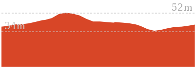
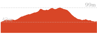
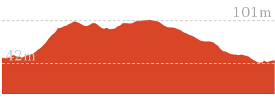
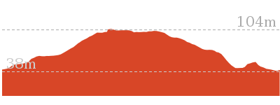
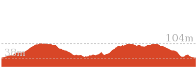
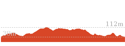
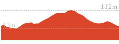
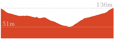
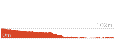
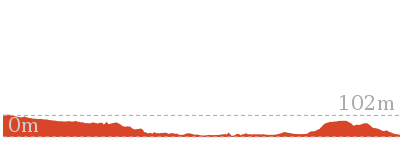
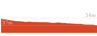
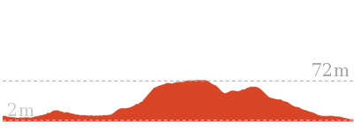
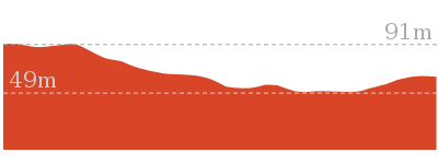
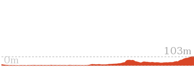
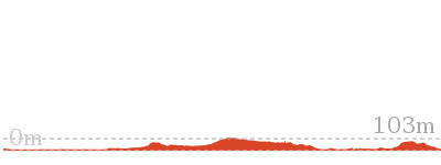
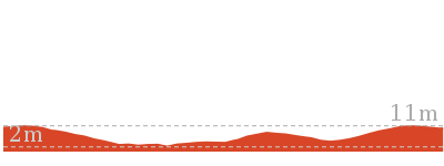
Cross sectional view of the Richley Reserve to Carnley Reserve Circuit bushwalking track

Analysis and summary of the altitude variation on the Richley Reserve to Carnley Reserve Circuit
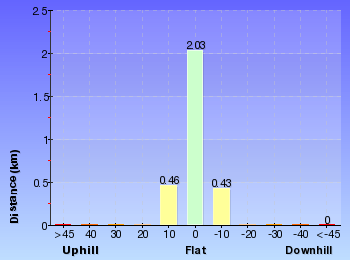
Overview of this walks grade – based on the AS 2156.1 – 2001
Under this standard, a walk is graded based on the most difficult section of the walk.
| Length | 2.9 km | ||
| Time | 1 hr 15 mins | ||
| . | |||
| Grade 3/6 Moderate track |
AS 2156.1 | Gradient | Gentle hills with occasional steps (2/6) |
| Quality of track | Smooth and hardened path (1/6) | ||
| Signs | Directional signs along the way (3/6) | ||
| Experience Required | No experience required (1/6) | ||
| Weather | Weather generally has little impact on safety (1/6) | ||
| Infrastructure | Generally useful facilities (such as fenced cliffs and seats) (1/6) |
Some more details of this walks Grading
Here is a bit more details explaining grading looking at sections of the walk
Gradient
Around 2.8km of this walk is flat with no steps, whilst the remaining 130m has gentle hills with occasional steps.
Quality of track
This whole walk, 2.9km follows a smooth and hardened path.
Signs
Around 2.2km of this walk is clearly signposted, whilst the remaining 770m has directional signs at most intersection.
Experience Required
This whole walk, 2.9km requires no previous bushwalking experience.
weather
This whole walk, 2.9km is not usually affected by severe weather events (that would unexpectedly impact safety and navigation).
Infrastructure
This whole walk, 2.9km is close to useful facilities (such as fenced cliffs and seats).
Similar walks
Other Nearby walks
Plan your trip to and from the walk here
The Richley Reserve to Carnley Reserve Circuit walk starts and ends at the Richley Reserve (Car Park) (gps: -32.932399, 151.70001)Your transport options to Richley Reserve (Car Park) are by;
(get details)
Fire Danger
Each park may have its own fire ban, this rating is only valid for today and is based on information from the RFS Please check the RFS Website for more information.Weather Forest
This walk starts in the Hunter weather district always check the formal BOM forecast or pdf before starting your walk.Forecast snapshot
Park Information & Alerts
Short URL = http://wild.tl/rrtcrc
Gallery images
There are other downloads I am still working on.
You will probably need to login to access these — still all free.
* KML (google earth file)
* GPX (GPS file)
Special Maps/ brochures
* A3 topo maps
* PDF with Lands Topo map base
* PDF with arial image (and map overlay)
I wanted to get the main site live first, this extra stuff will come in time.
Happy walking
Matt 🙂








Comments