La Perouse Historical Walk

30 mins
792 m Circuit

9 m
Easy track
(0km) Southern End of Cann Park → The Barrack Tower

140 m
2 mins
0m
0m
Easy track
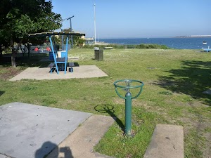
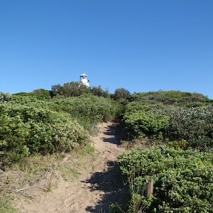
From the southern end of Cann Park (Anzac Parade, La Perouse)[1] and ‘Congwong Beach Walk’ sign[2], this walk initially follows a footpath toward the water and a stone tower[3]) for about 20m (past the road intersection) then turns right to cross Anzac Pd to find a ‘Botany Bay National Park’ sign[4]. This walk then passes between timber posts, walking across grass for about 50m, until coming to the locked stone tower (The Barrack Tower[5]).
(0.14km) The Barrack Tower → Top of Bare Island Trail

90 m
2 mins
2m
0m
Easy track
Continue straight: From the stone tower (The Barrack Tower[6]), this walk heads gently downhill, towards the water, over grass for about 80m. The walk then heads down the steps and across Anzac Rd[7] so find a few seats at the top of Bare Island Trail[8] beside the large ‘Botany Bay National Park’ sign[9].
(0.23km) Top of Bare Island trail → Bare Island Fortification

190 m
4 mins
3m
-13m
Easy track
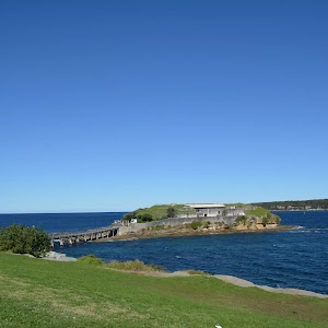
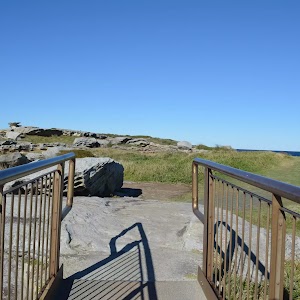
Continue straight: From the intersection[10], this walk heads away from Anzac Parade and seats following the (initally moderalty steep) driveway downhill[11] toward Bare Island, past the large ‘Botany Bay National Park’ sign[12]. This walk continues to follow the concrete then asphalt driveway for about 80m to find the start of the 100m long (3.8m wide) timber bridge[13]. This walk crosses the bridge[14], until coming to a large metal gate[15] and a ‘Bare Island Fortification’ sign[16] behind the gate. There are great views from the bridge. Bare Island is generally locked but guided tours are available. At the end of this side trip, retrace your steps back to the main walk then Turn left.
Bare Island Fortification
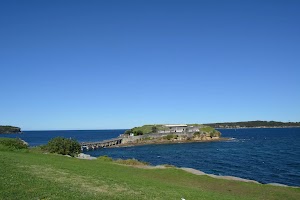
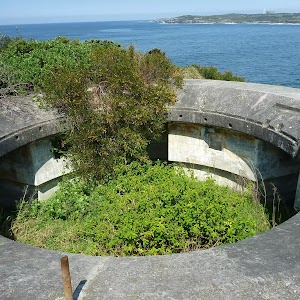
In 1885 the Bare Island Fortification on the northern side of Botany Bay was built in order to prevent foreign invasion and protect the water supply of the new colony. While the building is now accessible for tours, originally the only way of getting onto the island was by flying fox. The fortifications were decommissioned in the early 1900s. In 1912, Bare Island became a retirement home for war veterans from the Crimea, Sudan and China campaigns. It continued to operate as a retirement home until 1963, after this the Randwick District Historical Society became caretakers of the island. In 1967 it was passed onto the New South Wales Parks and Wildlife Service for use as a museum and tourist attraction. The Bare Island fort has now been declared a historical site. The Bare Island Fortification is available for tours on Sundays in the afternoons, for more information on how to book tours call 1300 072 757. There are many steps on the tour and is not considered wheelchair accessible. Bare Island is also one of the most popular scuba diving sites in New South Wales.
From the gate on the far side of the timber bridge is a steep set of timber steps that lead down to the rock platform [20], only access at low tide and seas.
(0.23km) Int of Bare Island Fortification & Anzac Rd → LaPerouse Museum

230 m
4 mins
2m
-5m
Easy track
Turn right: From the intersection[21], this walk follows the gravel track for about 80m, keeping the road on the right and water on the left, to find a roadside car park. Then this walk crosses the road and then the grass for about 170m (towards the large brick building[22]) to find the LaPerouse Museum[23].
La Perouse Museum
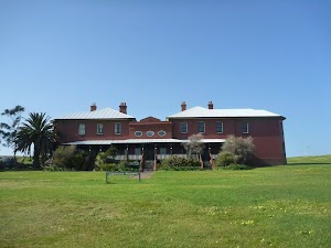
The La Perouse museum[24], in Botany Bay National Park, is housed in the historic cable station at La Perouse. The museum contains much information regarding Bare Island, the fate of La Perouse himself and Botany Bay National Park. There are many relics from ship wrecks, with maps and scientific instruments dating back to the 16th century. The museum contains over 2000 items, with one of the most significant collection items being a complete Atlas of the Voyage of La Perouse, consisting of 72 coloured drawings and maps, featuring places the expedition visited between 1785 and 1788. The museum is open Thursday to Sunday 10am to 4pm, closed Christmas Day.. Access to the building is via a steep staircase. More info.
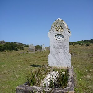
Tombstone of Pere Receveur
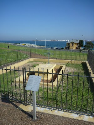
The tombstone near Bare Island belongs to Pere Receveur. Pere Laurent Receveur died on 17th February 1788 (due to injuries sustained en route in Samoa) and this grave is therefore the first known European grave on Australia’s soil. Receveur was a priest and botanist serving under De La Pereuse on the French scientific expedition to the Pacific. The tomb itself dates from 1829 but has since been restored several times .
Monument to De La Perouse
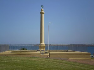
This monument to De La Perouse, near Cape Banks is named after Jean-Francois de Galaup (1741-88) (aka La Perouse), who landed on the northern shore of Botany Bay on 26 January 1788. Perouse’s ships, the Astrolabe and the Boussole, disappeared shortly after visiting Australia with no surviving crew, making the landing in Botany Bay the last known point of contact of the scientific expedition. More info.
(0.46km) LaPerouse Museum → Boatshed Cafe on Anzac Parade

110 m
2 mins
1m
-4m
Easy track
(0.58km) Boatshed Cafe on Anzac Parade → Southern End of Cann Park

220 m
4 mins
4m
0m
Easy track
Maps for the La Perouse Historical Walk walk
You can download the PDF for this walk to print a map.These maps below cover the walk and the wider area around the walk, they are worth carrying for safety reasons.
| Botany Bay | 1:25 000 Map Series | 91303S BOTANY BAY | NSW-91303S |
| Sydney | 1:100 000 Map Series | 9130 SYDNEY | 9130 |
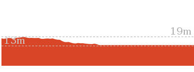
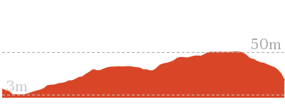
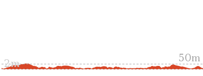
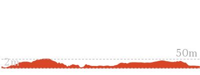
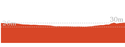
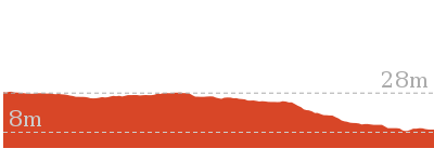
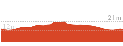
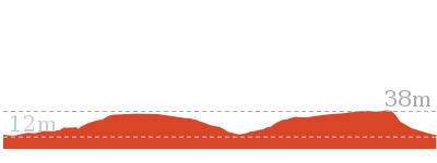
Cross sectional view of the La Perouse Historical Walk bushwalking track

Analysis and summary of the altitude variation on the La Perouse Historical Walk
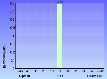
Overview of this walks grade – based on the AS 2156.1 – 2001
Under this standard, a walk is graded based on the most difficult section of the walk.
| Length | 792 m | ||
| Time | 30 mins | ||
| . | |||
| Grade 2/6 Easy track |
AS 2156.1 | Gradient | Gentle hills with occasional steps (2/6) |
| Quality of track | Clear and well formed track or trail (2/6) | ||
| Signs | Clearly signposted (1/6) | ||
| Experience Required | No experience required (1/6) | ||
| Weather | Weather generally has little impact on safety (1/6) | ||
| Infrastructure | Generally useful facilities (such as fenced cliffs and seats) (1/6) |
Some more details of this walks Grading
Here is a bit more details explaining grading looking at sections of the walk
Gradient
This whole walk, 790m has gentle hills with occasional steps.
Quality of track
This whole walk, 790m follows a clear and well formed track or trail.
Signs
This whole walk, 790m is clearly signposted.
Experience Required
This whole walk, 790m requires no previous bushwalking experience.
weather
This whole walk, 790m is not usually affected by severe weather events (that would unexpectedly impact safety and navigation).
Infrastructure
This whole walk, 790m is close to useful facilities (such as fenced cliffs and seats).
Similar walks
Other Nearby walks
Plan your trip to and from the walk here
The La Perouse Historical Walk walk starts and ends at the Southern End of Cann Park (gps: -33.988562, 151.23369)Your transport options to Southern End of Cann Park are by;
(get details)
Fire Danger
Each park may have its own fire ban, this rating is only valid for today and is based on information from the RFS Please check the RFS Website for more information.Weather Forest
This walk starts in the Metropolitan weather district always check the formal BOM forecast or pdf before starting your walk.Forecast snapshot
Park Information & Alerts
Short URL = http://wild.tl/lphw
Gallery images
There are other downloads I am still working on.
You will probably need to login to access these — still all free.
* KML (google earth file)
* GPX (GPS file)
Special Maps/ brochures
* A3 topo maps
* PDF with Lands Topo map base
* PDF with arial image (and map overlay)
I wanted to get the main site live first, this extra stuff will come in time.
Happy walking
Matt 🙂










Comments