Dubbo Gully to Upper Mangrove Cemetery

3 hrs 15 mins
7.2 km Return

450 m
Moderate track
(0km) Dubbo Gully Rd car park → Int of Dubbo Gully Rd and Upper Mangrove Creek Rd

2.5 km
1 hr 2 mins
104m
-277m
Moderate track
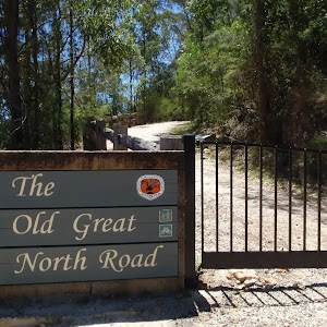
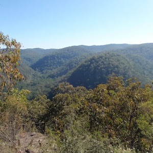
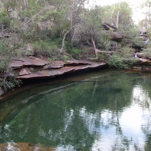
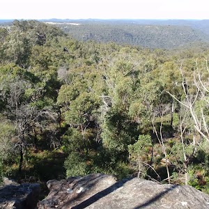
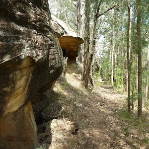
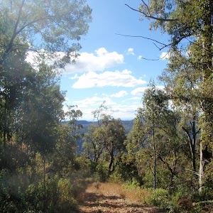
From the car park (a small clearing about 450m along the unsignposted Dubbo Gully Rd. Dubbo Gully Rd is found a by turning left off Waratah Rd when it becomes unsealed[1], about 4km from Mangrove Mountain shops), the walk follows the management trail down the hill and soon passes around a gate. There are some beautiful rock overhangs and scenery along this section of the walk. The walk continues to wind down the hill for a long while and eventually reaches the signposted intersection with the ‘Upper Mangrove Creek Rd’ (just before a bridge).
(2.49km) Int of Dubbo Gully Rd and Upper Mangrove Creek Rd → Upper Mangrove cemetery

1.1 km
22 mins
36m
-33m
Moderate track
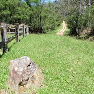
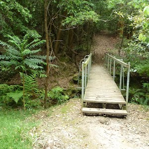
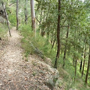
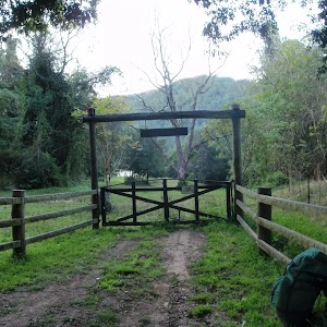
Continue straight: From the intersection, the walk follows the management trail (now Ten Mile Hollow Rd) and immediately crosses the longer bridge (leaving the shorter bridge with a gate to the right). The walk meanders along the trail for some time, passing an old ‘134’ sign to the right and a few old orange trees to the left. Soon after passing under some high voltage power lines, the walk arrives at a historic cemetery.
Upper Mangrove Cemetery
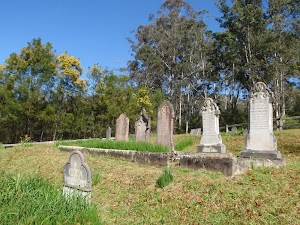
The Upper Mangrove Cemetery is on the western bank of Mangrove Creek, near the junction with Newmans Creek. The cemetery was part of St Thomas’ Church of England, however the church building was destroyed in the 2002 bushfires. Exploring the cemetery gives a glimpse into the history of the valley. You will find the stone remembering Alfred and Amanda Andrews who built ‘Fairview’ in 1922 and read of the loss of Leslie Starkey’s parents in 1913. On the other side of the road, up the hill, is the remains of of the old St Thomas’ Church building[3]. More info.
(3.6km) Upper Mangrove cemetery → Fairview Homestead

1.7 km
33 mins
56m
-45m
Moderate track
Continue straight: From the cemetery, the walk follows the management trail down the hill, leaving the cemetery to the left. The trail meanders along the valley for some time, passing a swampy area to the right and a large grassy clearing to the left. A short distance later, the walk reaches the signposted intersection with ‘Donny’s Track’[4].
Continue straight: From the intersection, the walk follows the management trail down the hill. The walk soon passes around a gate and continues a little further, passing around a swampy area to the left and immediately arriving at an intersection near a gate. The trail behind the gate leads to an old abandoned house and shed, which could provide some shelter.
Continue straight: From the intersection, the walk passes around the gate and follows the management trail steeply up the hill. The trail soon arrives at an old, abandoned house. At the end of this side trip, retrace your steps back to the main walk then Continue straight.
Fairview
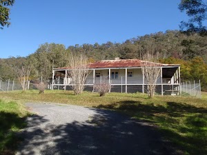
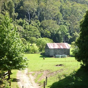
Fairview (550 Ten Mile Hollow Rd, Mangrove Creek) is a property with a homestead, built in 1922 by Alfred Andrews. The homestead and adjoining slab hut are now fenced to protect them, however the large corrugated iron shed on the south side is still open. The homestead was once a popular rest area for people traveling the North Road, via the Simpson track. The home was privately owned until 1973 when Gosford City Council acquired the land to protect the catchment area. The home was rented until 2002, when the tenants moved due to the threat of bushfires. The building is now in poor condition and the ‘Friends of Fairview’ are exploring ways to save the building and restore the history of the valley. Save Fairview More info.
Maps for the Dubbo Gully to Upper Mangrove Cemetery walk
You can download the PDF for this walk to print a map.These maps below cover the walk and the wider area around the walk, they are worth carrying for safety reasons.
| Mangrove | 1:25 000 Map Series | 91313N MANGROVE | NSW-91313N |
| Gosford | 1:100 000 Map Series | 9131 GOSFORD | 9131 |
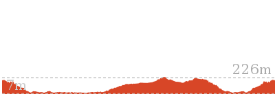
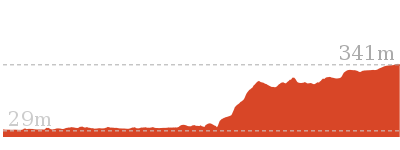
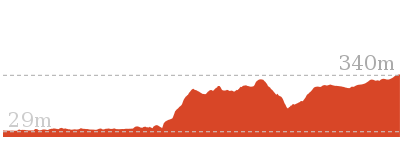
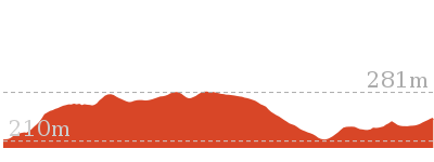
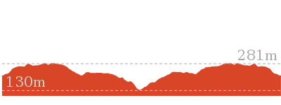
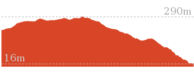
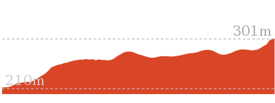
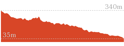
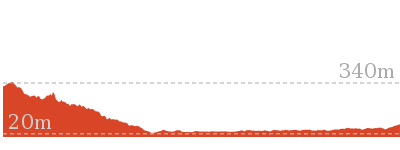
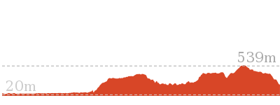
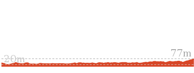
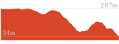
Cross sectional view of the Dubbo Gully to Upper Mangrove Cemetery bushwalking track

Analysis and summary of the altitude variation on the Dubbo Gully to Upper Mangrove Cemetery
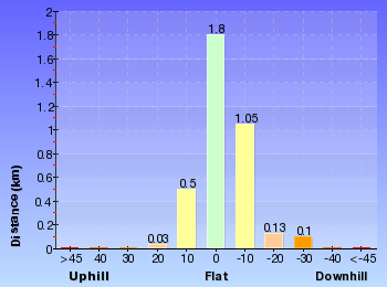
Overview of this walks grade – based on the AS 2156.1 – 2001
Under this standard, a walk is graded based on the most difficult section of the walk.
| Length | 7.2 km | ||
| Time | 3 hrs 15 mins | ||
| . | |||
| Grade 3/6 Moderate track |
AS 2156.1 | Gradient | Short steep hills (3/6) |
| Quality of track | Clear and well formed track or trail (2/6) | ||
| Signs | Directional signs along the way (3/6) | ||
| Experience Required | No experience required (1/6) | ||
| Weather | Weather generally has little impact on safety (1/6) | ||
| Infrastructure | Limited facilities, not all cliffs are fenced (3/6) |
Some more details of this walks Grading
Here is a bit more details explaining grading looking at sections of the walk
Gradient
Around 2.5km of this walk has short steep hills, whilst the remaining 1.1km has gentle hills with occasional steps.
Quality of track
This whole walk, 3.6km follows a clear and well formed track or trail.
Signs
Around 2.5km of this walk has directional signs at most intersection, whilst the remaining 1.1km is clearly signposted.
Experience Required
This whole walk, 3.6km requires no previous bushwalking experience.
weather
This whole walk, 3.6km is not usually affected by severe weather events (that would unexpectedly impact safety and navigation).
Infrastructure
This whole walk, 3.6km has limited facilities (such as not all cliffs fenced).
Similar walks
Other Nearby walks
Plan your trip to and from the walk here
The Dubbo Gully to Upper Mangrove Cemetery walk starts and ends at the Dubbo Gully Rd car park (gps: -33.293017, 151.15119)Your main transport option to Dubbo Gully Rd car park is by;
(get details)
Fire Danger
Each park may have its own fire ban, this rating is only valid for today and is based on information from the RFS Please check the RFS Website for more information.Weather Forest
This walk starts in the Hunter weather district always check the formal BOM forecast or pdf before starting your walk.Forecast snapshot
Park Information & Alerts
Short URL = http://wild.tl/dgtumc
Gallery images
There are other downloads I am still working on.
You will probably need to login to access these — still all free.
* KML (google earth file)
* GPX (GPS file)
Special Maps/ brochures
* A3 topo maps
* PDF with Lands Topo map base
* PDF with arial image (and map overlay)
I wanted to get the main site live first, this extra stuff will come in time.
Happy walking
Matt 🙂








Comments