The Welcome walk

30 mins
945 m One way

3 m
Easy track
(0km) Mangrove Boardwalk car park → Boardwalk seating area

350 m
5 mins
0m
0m
Very easy
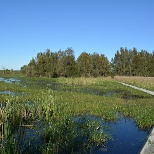
From the Mangrove Boardwalk car park[1] on Millams Rd Kooragang, (with the large ‘Welcome to Kooragang Wetlands’ sign[2]) this walk follows the ‘Mangrove Boardwalk’ arrow[3] along the timber boardwalk directly away from the road. This walk gently meanders along the boardwalk for about 80m to cross a bridge with (90cm high) hand railings[4], to come to a seat about 50m later. This walk then continues for the next 160m, passing a few information signs[5][6][7] to find another seat. The walk continues along the boardwalk through the open wetlands for another 60m to come to a third seat (on the left).
Mangroves

Mangroves are a type of resistant, salt tolerant and pretty cool tree. They are are a type of halophyte, a plant that grows in salty water. They are perfectly adapted for life in harsh coastal conditions and salt marshes like this one. The plants contain systems to manage the salt levels and root system to anchor in different areas from deep mud to rocky coastlines. The roots also have aerial shoots to help deal with the particular low oxygen levels of mud. The mangroves are great and environmentaly critical to the survival of many animals like crabs and birds.
(0.35km) Boardwalk seating area → Mangrove Boardwalk int.

190 m
3 mins
2m
-2m
Very easy
(0.54km) Mangrove Boardwalk int. → Schoolmasters House

60 m
1 mins
0m
0m
Very easy
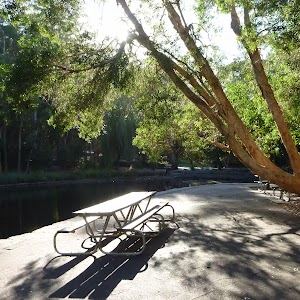
Veer left: From the intersection, this walk follows ‘schoolmasters house’ sign[14] gently uphill along the concrete path[15]. After about 20m the path leads past a picnic table (on the left) and continues for about 30m to come to the front of the ‘School Masters House’[16] (on the right). Access to the old school house is either via smaller steps[17] or around the far side by heading through the car park where there are a few picnic tables. At the end of this side trip, retrace your steps back to the main walk then Turn left.
Schoolmasters House
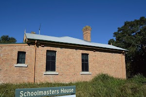
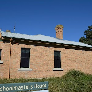
The schoolmaster’s house building is now used as the Kooragang Wetlands Information Centre. The building is open to the public (phone 02-4964 9308), with some interesting displays. In 1955 there were over 50 families and this school in the area, when the island was devastated by a massive flood. Following the flood, the area then was taken under state control and was leased for grazing. The school opened in 1873 and closed in 1968.
There are two main entrances. The back entrance has 3 14cm steps to get inside[21]. More info.
(0.54km) Mangrove Boardwalk int. → Cobbans Track int.

160 m
2 mins
1m
-1m
Very easy
Turn right: From the intersection, this walk follows ‘Cobbans Creek’ arrow sign[22] along the timber boardwalk keeping the open area to the left. After about 40m the boardwalk ends and this walk heads along an asphalt path[23], for about 10m to a seat and the ‘Sue’s Garden’ sign[24] (both on the left). From here this walk continues along the asphalt path for about 110m, passing two more seats and a picnic table (on the left) to cross a short timber bridge and come to the Cobbans Track T-intersection[25], marked by the ‘Cobbans Creek’ sign[26].
(0.69km) Cobbans Track int. → Cobbans car park

250 m
4 mins
0m
0m
Easy track
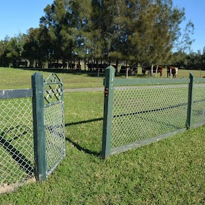
Turn left: From the intersection, this walk follows the wide gravel trail gently uphill, in the opposite direction of the ‘Cobbans Creek’ arrow [27], initially keeping the timber bridge to the left. This walk continues straight for about 250m to then head around the metal gate beside the timber bollards to the Cobbans car park[28], marked by the ‘Cobbans Track’ sign[29] just off the side of Millams Rd, Kooragang.
Maps for the The Welcome walk walk
You can download the PDF for this walk to print a map.These maps below cover the walk and the wider area around the walk, they are worth carrying for safety reasons.
| Beresfield | 1:25 000 Map Series | 92323N BERESFIELD | NSW-92323N |
| Newcastle | 1:100 000 Map Series | 9232 NEWCASTLE | 9232 |
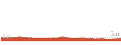
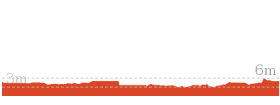
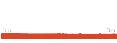
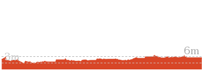
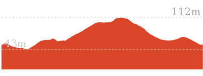
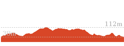
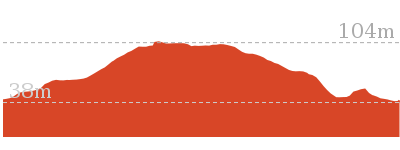
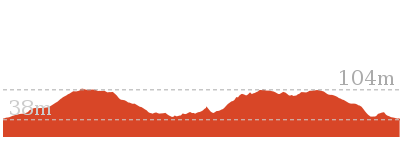
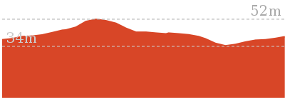
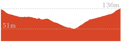
Cross sectional view of the The Welcome walk bushwalking track

Analysis and summary of the altitude variation on the The Welcome walk
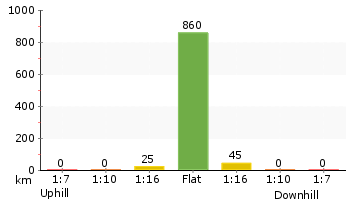
Accessibility summary information for the The Welcome walk
Parking: There are 0 designated accessible parking areas on this walk.
Toilets: There are 0 designated accessible toilets on this walk.
Seats: There are 7 places to sit on this walk. They are on average 110m apart, with a maximum gap of 240m.
Hazards: There are 0 specific noteable accessability related hazards on this walk.
Toilets: There are 0 designated accessible toilets on this walk.
Seats: There are 7 places to sit on this walk. They are on average 110m apart, with a maximum gap of 240m.
Hazards: There are 0 specific noteable accessability related hazards on this walk.
Accessibility Details
Overview of this walks grade – based on the AS 2156.1 – 2001
Under this standard, a walk is graded based on the most difficult section of the walk.
| Length | 945 m | ||
| Time | 30 mins | ||
| . | |||
| Grade 2/6 Easy track |
AS 2156.1 | Gradient | Flat, no steps (1/6) |
| Quality of track | Clear and well formed track or trail (2/6) | ||
| Signs | Clearly signposted (1/6) | ||
| Experience Required | No experience required (1/6) | ||
| Weather | Weather generally has little impact on safety (1/6) | ||
| Infrastructure | Generally useful facilities (such as fenced cliffs and seats) (1/6) |
Some more details of this walks Grading
Here is a bit more details explaining grading looking at sections of the walk
Gradient
This whole walk, 950m is flat with no steps.
Quality of track
Around 690m of this walk follows a smooth and hardened path, whilst the remaining 250m follows a clear and well formed track or trail.
Signs
This whole walk, 950m is clearly signposted.
Experience Required
This whole walk, 950m requires no previous bushwalking experience.
weather
This whole walk, 950m is not usually affected by severe weather events (that would unexpectedly impact safety and navigation).
Infrastructure
This whole walk, 950m is close to useful facilities (such as fenced cliffs and seats).
Similar walks
Other Nearby walks
Plan your trip to and from the walk here
The The Welcome walk walk starts at the Mangrove Boardwalk car park (gps: -32.844726, 151.69741)Your main transport option to Mangrove Boardwalk car park is by;
(get details)
The The Welcome walk ends at the Cobbans car park (gps: -32.84559, 151.70238)
Your main transport option to Cobbans car park is by;
(get details)
Fire Danger
Each park may have its own fire ban, this rating is only valid for today and is based on information from the RFS Please check the RFS Website for more information.Weather Forest
This walk starts in the Hunter weather district always check the formal BOM forecast or pdf before starting your walk.Forecast snapshot
Park Information & Alerts
Short URL = http://wild.tl/tww
Gallery images
There are other downloads I am still working on.
You will probably need to login to access these — still all free.
* KML (google earth file)
* GPX (GPS file)
Special Maps/ brochures
* A3 topo maps
* PDF with Lands Topo map base
* PDF with arial image (and map overlay)
I wanted to get the main site live first, this extra stuff will come in time.
Happy walking
Matt 🙂







Comments