Audley to Gibraltar Rock

45 mins
2.2 km Return

55 m
Easy track
Audley
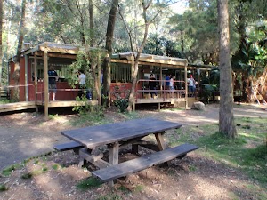
Audley in the Royal National Park is where you will find the visitor information center, toilets, kiosk, boat shed (row boat hire), weir, water, BBQ’s and plenty of picnic facilities. Take a step back in time and explore some of the preserved building like the old dance hall, enjoy wandering the grounds or grab an ice cream.
(0km) Audley Village car park → Audley Cafe

110 m
2 mins
4m
0m
Very easy
From the Audley Village car park (north of the buildings located at 2 Lady Carrington Dr, Royal National Park), this walk follows the ‘Audley Dancehall’ arrow on the ‘Ironbark Flat’ sign[1] along the concrete path[2] (toward picnic area and buildings). This walk continues along the path for about 70m, passing a series of seats and a picnic area with 2 picnic tables and 2 BBQs[3][4] to come to the signpost intersection[5] with another concrete path (leading toward the male and female toilets up the stairs[6]). From the intersection this walk continues straight following the ‘Audley Dancehall’ sign[7] towards the building with accessible toilets, ‘Royal National Park Visitor Centre’[8] with a shop[9] and the ‘Weir Cafe’[10], beside the path.
Audley Picnic area
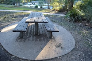
Audley Picnic area is a large grassy area[11] with beautiful views across the Hacking River. There are 2 picnic tables with 2 sheltered double gas BBQs[12][13]. A few benches[14] are scattered around the area. Closer to the ‘Audley Dancehall’ building[15] there’s a signposted toilet block (just up the short staircase)[16].
Audley Cafe
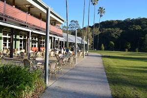
‘Weir Cafe’[17] is located at the ‘Audley Dancehall’ building[18]. The building is separated into two areas, one is the cafe[19] and the other one is the ‘Royal National Park Visitor Centre’[20] with a gift shop[21]. Hot and cold food as well as drinks are available. Lunch meals range from about $15-25.
(0.11km) Audley Cafe → Commonwealth Pavilion car park

80 m
1 mins
1m
-4m
Very easy
Continue straight: From the cafe[22], this walk follows the concrete path (keeping the river on your right). This walk continues along the path for about 90m, passing 2 seats, the ‘Currawong Flat and Varneys Bridge’ sign[23] and the large sheltered ‘Commonwealth Pavilion’ picnic area[24] to come to a small parking lot (just past the ‘Currawong Flat and Varneys Bridge’ postsign[25] and timber bollards).
Commonwealth Pavilion
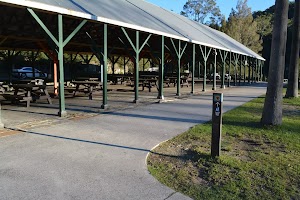
The large sheltered ‘Commonwealth Pavilion’ picnic area[26] offers 19 picnic tables and 4 single gas bbqs (high 90cm, grill area 43cm wide). From the picnic area there are beautiful views over the Hacking River and the picnic area. This is a great spot to see Cockatoos[27]. There is a cafe, information center, toilets and other facilities nearby.
(0.18km) Commonwealth Pavilion car park → Lady Carrington Drive gate (Willow Tree)

470 m
9 mins
18m
-11m
Very easy
Continue straight: From the car park[28], this walk follows the ‘Currawong Flat and Varneys Bridge’ sign along the asphalt road (away from the sheltered ‘Commonwealth Pavilion’ picnic area) toward[29] the timber ‘Varneys Bridge’[30] (with handrails) over the Hacking River.
Continue straight: From the bridge, this walk follows the ‘Willow Tree & Fig Tree Flat’ sign[31] along ‘Lady Carrington Drive’[32], keeping the river to the right. This walk continues along the road for about 290m past the ‘Willow Tree Flat’ sign[33] to come to a toilet block (on the right). From the toilets this walk continues along the road for about 60m to come to a ‘Y’ intersection[34] with a ‘Lady Carrington Drive’ signpost[35] and locked gate[36].
Continue straight: From the bridge, this walk follows the ‘Willow Tree & Fig Tree Flat’ sign[31] along ‘Lady Carrington Drive’[32], keeping the river to the right. This walk continues along the road for about 290m past the ‘Willow Tree Flat’ sign[33] to come to a toilet block (on the right). From the toilets this walk continues along the road for about 60m to come to a ‘Y’ intersection[34] with a ‘Lady Carrington Drive’ signpost[35] and locked gate[36].
Willow Tree

Willow Tree is a picnic area[37] in the Royal National Park. It is found on the south side of Audley, between the old Lady Carrington Drive and the Hacking River. The picnic area has a large shelter[38] with 4 picnic tables, an open grassy area[39], parking[40], BBQ’s, tap water, garbage bins[41], recycling and toilets. The picnic area stretches along the river bank and provides a lovely spot to stop and enjoy the park[42] .
Lady Carrington Drive
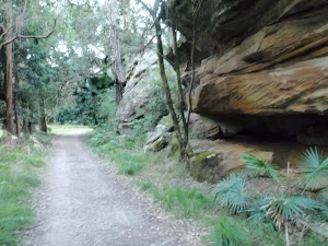
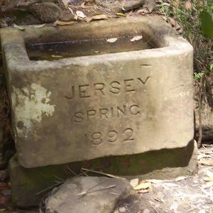
Opened in 1886 by Lady Carrington, this road was formally named ‘Lady Carrington Road’ (later changed to ‘drive’), and started on the southern side of the then newly constructed Audley weir. The road became popular among people exploring the region. The road follows the Hacking River’s east bank and then Bola Creek to Sir Bertram Stevens Drive. Much history has been preserved, with several drinking troughs still filling with water and many sandstone retaining walls still standing. The brooks that the old road crosses have been named using the traditional names of birds, the following is a list with the English name in brackets. Mullion (Eagle), Wurrul (Bee Eater), Burowa (Bustard), Karonga (White Crane), Gorra Worra (Laughing Jackass), Buralga (Native Companion), Kobardo (Parrot), Birumba (Plover), Dirijiri (Wagtail), Murrindum (Quail), Dumbal (Crow), Tamur (Bronze winged Pigeon), Burunda (Swan), Karani (Duck), Palona (Hawk) Brooks.
(0.65km) Lady Carrington Drive gate (Willow Tree) → Gibraltar Rock

430 m
8 mins
6m
-11m
Easy track
Continue straight: From the intersection, this walk follows the ‘Lady Carrington Drive’ sign[43] around the locked gate[44] and along the management trail[45] (keeping the picnic area and river to the right). This walk winds along the trail gently uphill for about 400m to step onto the cobblestone section below the overhanging Gibraltar Rocks[46] beside the picnic table.
Gibraltar Rock
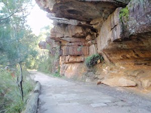
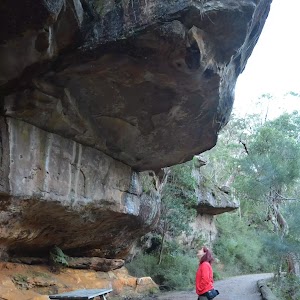
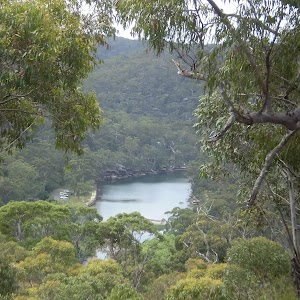
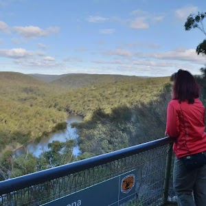
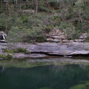
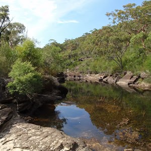
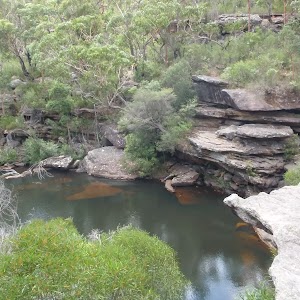
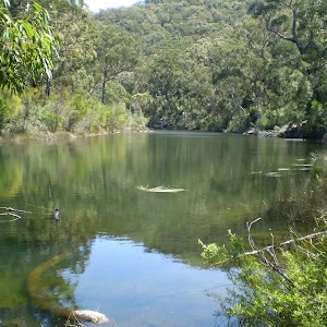
Gibraltar Rock[47], Royal National Park, is a sandstone overhang found near the northern end of Lady Carrington Drive. The old road passes under the rocks and is home to a small section of sandstone cobblestone[48]. At this point, the old road offers great views of the Hacking River[49] and across to Wattle Forest picnic area. These and many other sandstone formations, together with the history, make this old road quite interesting to explore. There is a picnic table under the overhang.
Maps for the Audley to Gibraltar Rock walk
You can download the PDF for this walk to print a map.These maps below cover the walk and the wider area around the walk, they are worth carrying for safety reasons.
| Port Hacking | 1:25 000 Map Series | 91294N PORT HACKING | NSW-91294N |
| Port Hacking | 1:100 000 Map Series | 9129 PORT HACKING | 9129 |
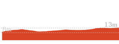
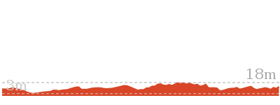
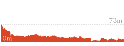
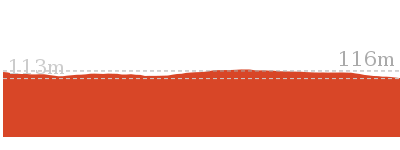
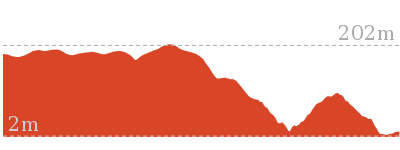
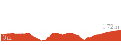
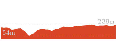
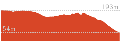
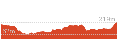
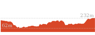
Cross sectional view of the Audley to Gibraltar Rock bushwalking track

Analysis and summary of the altitude variation on the Audley to Gibraltar Rock
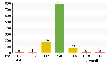
Accessibility summary information for the Audley to Gibraltar Rock
Parking: There are 2 designated accessible parking areas on this walk.
They are 190m apart.
Toilets: There are 2 designated accessible toilets on this walk. They are 100m apart.
Seats: There are 7 places to sit on this walk. They are on average 180m apart, with a maximum gap of 550m.
Hazards: There are 1 specific noteable accessability related hazards on this walk.
Trip Hazard An 8cm trip hazard between dirt and cobblestones. Found about 1070m into the walk.
Accessibility Details
Overview of this walks grade – based on the AS 2156.1 – 2001
Under this standard, a walk is graded based on the most difficult section of the walk.
| Length | 2.2 km | ||
| Time | 45 mins | ||
| . | |||
| Grade 2/6 Easy track |
AS 2156.1 | Gradient | Flat, no steps (1/6) |
| Quality of track | Clear and well formed track or trail (2/6) | ||
| Signs | Clearly signposted (1/6) | ||
| Experience Required | No experience required (1/6) | ||
| Weather | Weather generally has little impact on safety (1/6) | ||
| Infrastructure | Generally useful facilities (such as fenced cliffs and seats) (1/6) |
Some more details of this walks Grading
Here is a bit more details explaining grading looking at sections of the walk
Gradient
This whole walk, 1.1km is flat with no steps.
Quality of track
Around 650m of this walk follows a smooth and hardened path, whilst the remaining 430m follows a clear and well formed track or trail.
Signs
This whole walk, 1.1km is clearly signposted.
Experience Required
This whole walk, 1.1km requires no previous bushwalking experience.
weather
This whole walk, 1.1km is not usually affected by severe weather events (that would unexpectedly impact safety and navigation).
Infrastructure
This whole walk, 1.1km is close to useful facilities (such as fenced cliffs and seats).
Similar walks
Other Nearby walks
Plan your trip to and from the walk here
The Audley to Gibraltar Rock walk starts and ends at the Audley Village car park (gps: -34.074286, 151.05661)Your main transport option to Audley Village car park is by;
(get details)
Fire Danger
Each park may have its own fire ban, this rating is only valid for today and is based on information from the RFS Please check the RFS Website for more information.Weather Forest
This walk starts in the Metropolitan weather district always check the formal BOM forecast or pdf before starting your walk.Forecast snapshot
Park Information & Alerts
Short URL = http://wild.tl/atgr
Gallery images
There are other downloads I am still working on.
You will probably need to login to access these — still all free.
* KML (google earth file)
* GPX (GPS file)
Special Maps/ brochures
* A3 topo maps
* PDF with Lands Topo map base
* PDF with arial image (and map overlay)
I wanted to get the main site live first, this extra stuff will come in time.
Happy walking
Matt 🙂









Comments